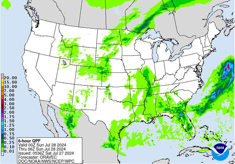
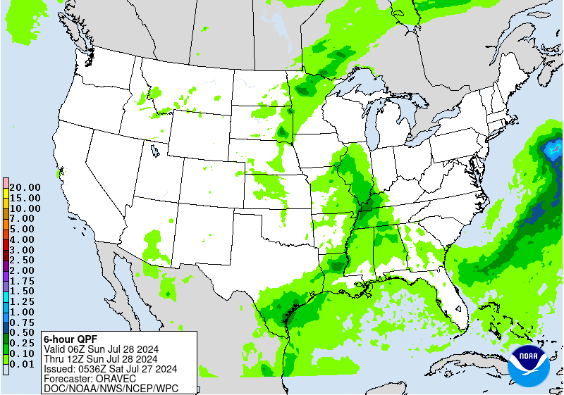
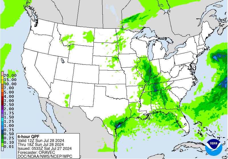
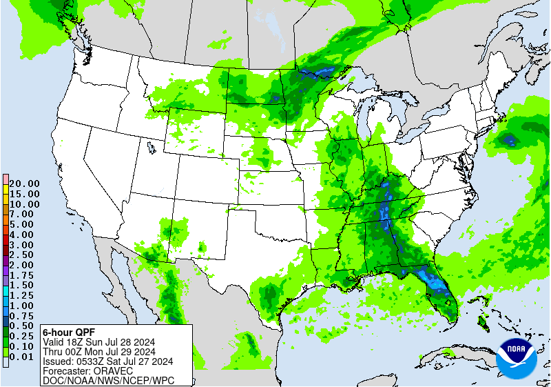
Excessive Rainfall Discussion
NWS Weather Prediction Center College Park MD
742 PM EDT Mon Oct 12 2026
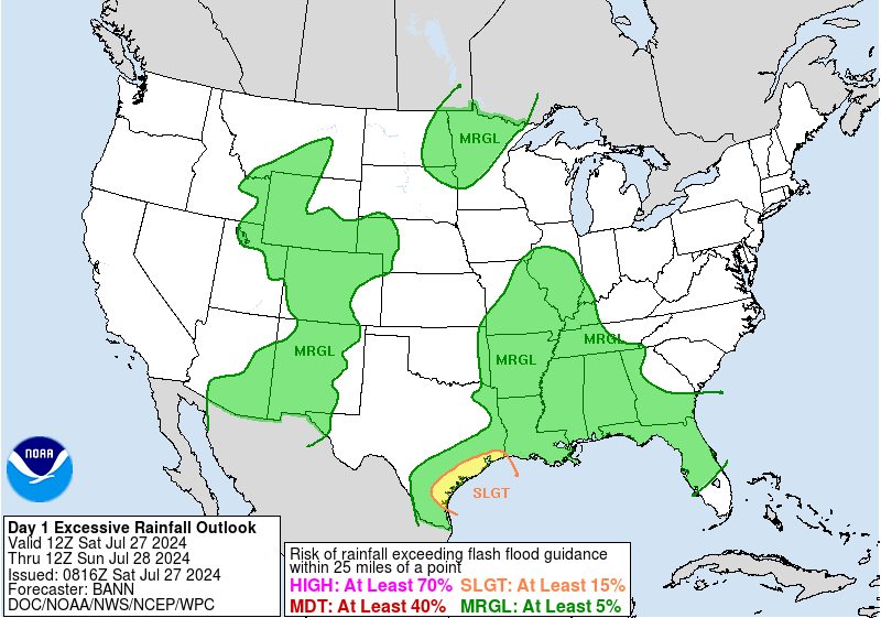
Day 1
Valid 01Z Tue Oct 13 2026 - 12Z Tue Oct 13 2026
...THERE IS A MARGINAL RISK OF EXCESSIVE RAINFALL ACROSS PARTS OF
THE WEST...
..Portions of the West...
A potent upper low (ULL) lies in the Great Basin. Moisture across
the West (0.5-1" precipitable water values), considering the modest
1000-500 hPa thickness values, is sufficient for showers and low-
topped convection with heavy rainfall. The main problem today from
a convective standpoint has been ML/MU CAPE being somewhat low,
with only small pockets of 500+ J/kg across the West, an issue not
expected to improve this evening and overnight. Because of this,
the coverage of 0.5"+ and 1"+ an hour totals has been isolated.
Dropped the risk to Marginal on this update due to the sparsity of
heavy rainfall. Isolated flash flooding/excessive rainfall concerns
remain possible into early Tuesday.
Roth
Day 1 threat area:
www.wpc.ncep.noaa.gov/qpf/94epoints.txt
Excessive Rainfall Discussion
NWS Weather Prediction Center College Park MD
742 PM EDT Mon Oct 12 2026
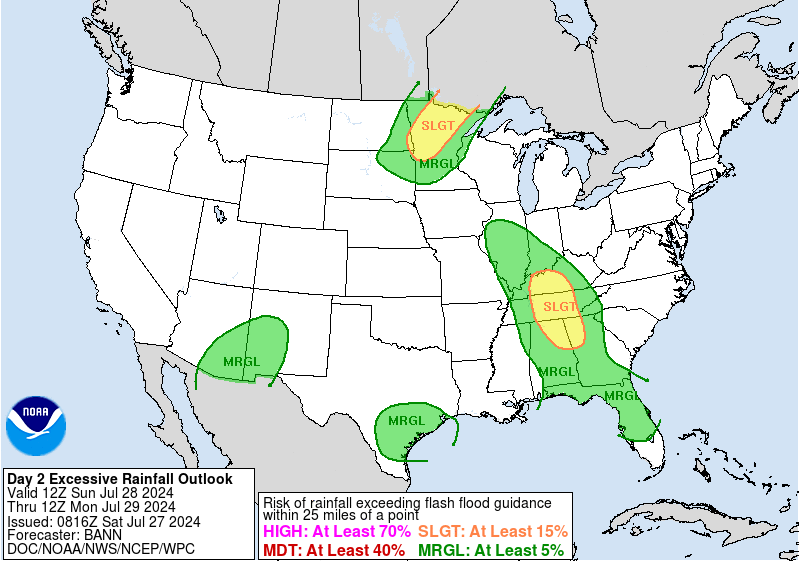
Day 2
Valid 12Z Tue Oct 13 2026 - 12Z Wed Oct 14 2026
...THERE IS A MARGINAL RISK OF EXCESSIVE RAINFALL ACROSS PORTIONS
OF THE GREAT BASIN, ALONG WITH THE CENTRAL AND SOUTHERN PLAINS...
2030Z Update...
Deterministic QPF and the ensemble probabilities changed little
with the 12Z suite of numerical guidance. Changes were minimal.
Bann
Previous Excessive Rainfall Discussion
...Great Basin...
Upper low across NV will shift slowly eastward into the interior
west with sights on UT and surrounds leading to an isolated flash
flood threat continuing directly underneath the low itself. As of
now, the probabilities for >1" are relatively benign in terms of
coverage for >50%. That said, the max probability of 50-80% is
centered over the valley between Provo up to Logan which is right
in the population center for the state, and coincides with more
urbanization factors that could promote run off potential. The area
has seen several inches of rainfall with this setup leading into
Tuesday, so antecedent conditions are more favorable for these
isolated flash flood prospects compared to normal. Considering the
setup has not really wavered in terms of its evolution, felt it was
a case to maintain continuity in the forecast with a small MRGL
risk placed over the western and north-central portion of the state
with the centroid over the valley of northern UT.
...Central and Southern Plains...
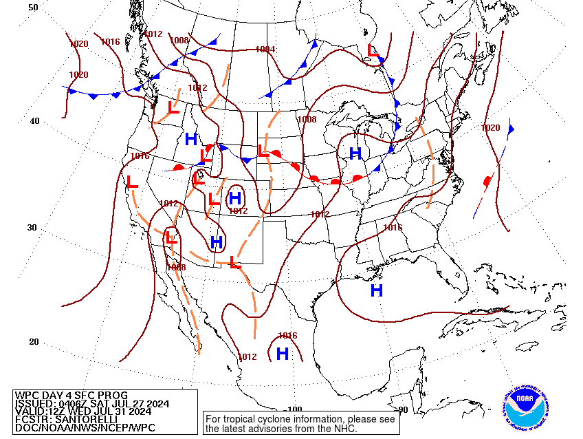
Longwave pattern across the Central and Southern U.S. will
materialize in such that a broad convective evolution is
increasingly favorable for late-Tuesday afternoon, carrying into
Wednesday morning. The western ULL will slowly pivot eastward into
UT by Tuesday with increasingly diffluent flow positioned across
the Central Plains and portions of the Southern High Plains as we
move into the second half of the D2. A broad upper jet alignment
will arc over the the northern tier of the CONUS leading to a well
placed RER jet core centered over the Central U.S. with the ascent
maximized likely south of a latitude of I-80. The current progs are
for lee cyclogenesis to begin the period prior, but exhibit very
little forward propagation from its initiation point as the pattern
evolution out west motions very slowly. Additional input of energy
streaming poleward out of the Eastern Pacific, up through Mexico,
and into the High Plains will occur in tandem with the overall
longwave evolution as energy on the northern edge of Hurricane
Simon will advance north-northeast into the region around the
western periphery of a broad ridge centered over the Lower
Mississippi Valley. The ample ascent provided by both mid-level
vorticity advection and improving large scale jet dynamics within
deep layer moisture presence over the Plains will aid in the
production of convection as we step into the peak diurnal
instability hours, and beyond.
The setup also calls for an integration of a LLJ development
around 00z Wednesday which will only act as a convergent piece of
this puzzle as the addition of low- level southerly enhancement
will only act to assist the convective pattern as increasing low-
level shear and maintenance of general buoyancy across the Plains
will allow for a maturation of area convection over the Central
Plains and Mid-Mississippi Valley. Model consensus indicates a
blossoming of convective coverage across KS/MO/OK by nightfall on
Tuesday with an expected initiation of convection over west TX
thanks to the LLJ interaction with the streaming mid- level energy
ejecting out of Mexico. Generally slow cell motions and potential
for repeating convection are anticipated over the entire stretch
from southwest TX up through the Central Plains with the latest
forecast soundings across the South-Central U.S. indicative of
weakening mean winds and backing of the low-level flow that would
support some back-building potential of precipitation in-of OK/KS
into western MO. As of this time, the relative FFG's in the area
would support at least the initial threat of heavy rainfall as
current QPF means hover between 1-2" over a broad area from the
Permian Basin up into eastern KS and adjacent western MO.
Deterministic outputs do signal some local totals >3" across
portions of the aforementioned area which would place them near the
3 and 6hr FFG thresholds in place across these particular areas.
We are still at the very end of the HREF output for this setup
meaning we are missing the key final 12hrs of the period to see how
the CAMs handle the magnitude of the convection for this time
frame. At first glance, there may be enough of a signal for a SLGT
risk somewhere across the High Plains extending northeast, so stay
tuned over the next few forecast cycles for possible upgrades for
the period. For now, the previous MRGL risk from the Big Bend up
through the southern tier of the Midwest remains consistent with
this evening's guidance.
Kleebauer
Day 2 threat area:
www.wpc.ncep.noaa.gov/qpf/98epoints.txt
Excessive Rainfall Discussion
NWS Weather Prediction Center College Park MD
742 PM EDT Mon Oct 12 2026
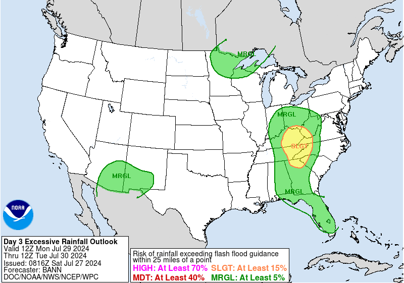
Day 3
Valid 12Z Wed Oct 14 2026 - 12Z Thu Oct 15 2026
...THERE IS A SLIGHT RISK OF EXCESSIVE RAINFALL ACROSS PORTIONS OF
THE SOUTHERN HIGH PLAINS INTO THE CENTRAL PLAINS AND LOWER MISSOURI
VALLEY...
2030Z Update...
The large-scale picture remains largely the same as in the previous
outlook with respect to deep moisture returning to the Central and
Southern Plains and the associated potential for heavy to excessive
rainfall. The area over the Plains still remains a candidate to be
upgraded to a higher outlook category. However...rainfall amounts
remained similar to the previous issuance and no particular signal
appeared to warrant an upgrade at this point. As the outlook gets
closer to being valid, more short-range, hi-resolution guidance
will be available which will help clarify the potential.
Bann
Previous Excessive Rainfall Discussion
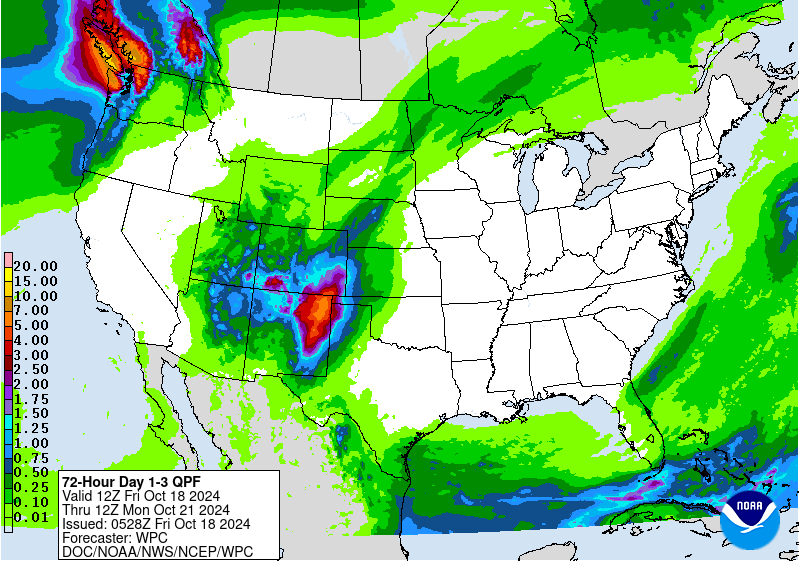
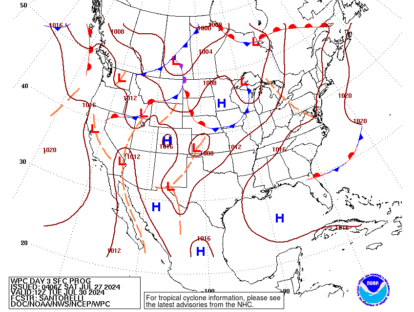
A generally classic setup for persistent heavy rainfall will
materialize over the Central and Southern U.S. come mid-week with a
vast, arcing jet situated from the Central Rockies to the Canadian
Maritimes. At the surface, a slow-moving surface low with attendant
frontal alignments will pivot meander over the Front Range with a
cold front at the base making headway through the Southern Rockies
into the Southern High Plains by the end of the forecast cycle with
a press of Pacific air in wake of the front. The combination of
large scale ascent situated under a broad RER of the upper jet
along with ample moisture advected up out of the Gulf and from some
of the remnants of now Hurricane Simon being pulled poleward will
create a broad convective regime with general QPF maxima occurring
during peak diurnal instability and overnight when the nocturnal
LLJ initiates over the Plains. Consensus among all guidance for a
prolonged heavy rain event has allowed for increased confidence in
both the longevity and magnitude of potential rainfall from
southwest TX up through the Mid-Mississippi Valley, arcing as far
east as the Ohio Valley another cold front on the leading edge of a
strong surface high moving over the northern tier of the CONUS.
With PWAT anomalies running consistently between +2 to +3 standard
deviations over much of the Central and Southern U.S. into the
western Ohio Valley, the prospects of convection capable of
rainfall rates between 1-2"/hr or greater are much more viable
which will spell for flash flood potential, especially when you
couple with what will fall the period prior to prime the upper
layer of the soils.
The previous SLGT risk was extended down through all of southwest
TX with an extension of the risk a bit more north and west given
the trends in ensembles and general bias to these more meridional
patterns where the evolution leans slower in their progression.
Higher risks in future forecasts are plausible in this particular
setup, so stay tuned for the latest updates over the course of the
week ahead.
Kleebauer
Day 3 threat area:
www.wpc.ncep.noaa.gov/qpf/99epoints.txt
Excessive Rainfall Discussion
NWS Weather Prediction Center College Park MD
742 PM EDT Mon Oct 12 2026
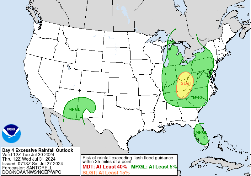
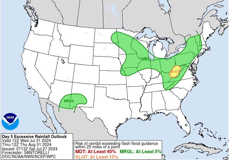
Day 4 and Day 5
Valid 12Z Thu Oct 15 2026 - 12Z Sat Oct 17 2026
...THERE IS A SLIGHT RISK OF EXCESSIVE RAINFALL OVER PORTIONS OF
SOUTHERN AND CENTRAL PLAINS ON THURSDAY/THURSDAY NIGHT...
Southern Plains into the Lower Great Lakes & WV...
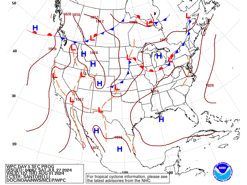
An upper level low in CO to start of the period eventually phases
with a northern stream trough moving through the Northern Plains on
Thursday, with a mid- to upper-level shear line connecting this
feature to a new closed low near the western International Border
with Mexico. This will allow for a continuation of favorable right
entrance region jet dynamics near an axis of precipitable water
values of 1.5-2". A wave in the Central Plains moves northeast,
luring a warm front in the low- levels northward. This splits the
heavy rainfall pattern in two, with the strongest heavy rain signal
in the Southern Plains, where the Slight Risk was maintained. GFS
guidance shows MU CAPE in the 250-500 J/kg range, so believe low-
to mid- level frontogenesis will play a role in enhancing rainfall
amounts. Regardless, hourly rain amounts to 1-2" should be possible
even with the low instability forecast. Considering the rainfall
expected on prior days, there should be some degree of saturation
by the time Thursday arrives.
Near and ahead of the surface wave moving from the Central Plains
into the Great Lakes, instability is also low and the boundary will
be moving. For now, kept a Marginal Risk near and ahead of the
wave from northern MO through the southern Great Lakes, including
WV. It's possible that guidance instability forecast will grow as
we get closer to the event, and if it does, a Slight Risk could
eventually become necessary for portions of the Midwest/Corn Belt.
Southwest...
A closed low develops over the region and drops southwest, luring
in moisture from the east as the low- to mid-level flow strengthens
from the direction of the Southern Plains/northwest Gulf.
Precipitable water values are forecast to be in the 1-1.5" range.
Heavy rainfall could develop where moisture is sufficient from the
TX Big Bend westward along the International Border into
southernmost CA. The main problem appears to be instability, where
the 12z GFS shows ~100 J/kg of MU CAPE. Since the guidance has the
potential of trending upward with their instability values as you
get closer in time, we appear to have enough for the Marginal Risk
from continuity, though extended it westward somewhat. Hourly rain
amounts to 0.5-1" appear probable given the forecast instability,
which would be a problem in burn scars and arroyos/dry washes.
Roth
Excessive Rainfall Discussion
NWS Weather Prediction Center College Park MD
742 PM EDT Mon Oct 12 2026
Day 4 and Day 5
Valid 12Z Thu Oct 15 2026 - 12Z Sat Oct 17 2026
...THERE IS A SLIGHT RISK OF EXCESSIVE RAINFALL OVER PORTIONS OF
SOUTHERN AND CENTRAL PLAINS ON THURSDAY/THURSDAY NIGHT...
Southern Plains into the Lower Great Lakes & WV...
An upper level low in CO to start of the period eventually phases
with a northern stream trough moving through the Northern Plains on
Thursday, with a mid- to upper-level shear line connecting this
feature to a new closed low near the western International Border
with Mexico. This will allow for a continuation of favorable right
entrance region jet dynamics near an axis of precipitable water
values of 1.5-2". A wave in the Central Plains moves northeast,
luring a warm front in the low- levels northward. This splits the
heavy rainfall pattern in two, with the strongest heavy rain signal
in the Southern Plains, where the Slight Risk was maintained. GFS
guidance shows MU CAPE in the 250-500 J/kg range, so believe low-
to mid- level frontogenesis will play a role in enhancing rainfall
amounts. Regardless, hourly rain amounts to 1-2" should be possible
even with the low instability forecast. Considering the rainfall
expected on prior days, there should be some degree of saturation
by the time Thursday arrives.
Near and ahead of the surface wave moving from the Central Plains
into the Great Lakes, instability is also low and the boundary will
be moving. For now, kept a Marginal Risk near and ahead of the
wave from northern MO through the southern Great Lakes, including
WV. It's possible that guidance instability forecast will grow as
we get closer to the event, and if it does, a Slight Risk could
eventually become necessary for portions of the Midwest/Corn Belt.
Southwest...
A closed low develops over the region and drops southwest, luring
in moisture from the east as the low- to mid-level flow strengthens
from the direction of the Southern Plains/northwest Gulf.
Precipitable water values are forecast to be in the 1-1.5" range.
Heavy rainfall could develop where moisture is sufficient from the
TX Big Bend westward along the International Border into
southernmost CA. The main problem appears to be instability, where
the 12z GFS shows ~100 J/kg of MU CAPE. Since the guidance has the
potential of trending upward with their instability values as you
get closer in time, we appear to have enough for the Marginal Risk
from continuity, though extended it westward somewhat. Hourly rain
amounts to 0.5-1" appear probable given the forecast instability,
which would be a problem in burn scars and arroyos/dry washes.
Roth